

GEO NAVIGATOR


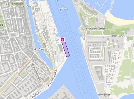
Kurs/Position
AIS Status :
Moving
Kurs:
360.0° / 0.0
Kompasskurs:
91.0° / 0.0
Status:
moored
Location:
Rostock (Warnemünde)
Gebiet:
Mecklenburger Bucht
Zuletzt empfangen::
2026-10-05
vor 34 Tagen
vor 34 Tagen
Source:
T-AIS
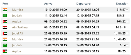
Die letzten Häfen
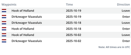
Die letzten Wegpunkte
Die neuesten Nachrichten
Ship started listing due to jammed ropes
The fire department and the German Lifeboat Association) Operation (DLRG) werealerted after the 'Geo Navigator' had started to develop a list to starboard side at the quay in Stadersand near the Schwinge estuary. It turned out that Jammed ropes had caused the ship to list at low tide on the morning of June 14, 2025. Initially, a water ingress had been feared. The firefighters and the DLRG eventually released the jammed ropes and securely moored the ship. There were no people on board. The owner of the ship has been contacted. After about an hour, the approximately 24 firefighters and DLRG personnel could be stood down again. Report with photo: https://www.tageblatt.de/Lokales/Feuerwehreinsatz-in-Stadersand-Schiff-in-Schraeglage-666247.html
News schreibenShip master data
Vessel Name Original :
Imo :
Mmsi :
Callsign Original :
Flag Normalized :
My Vessel Type :
Port Of Registry :
Service Speed :
Status Of Ship Standardized :
Status Date Normalized :
Hull Type :
Hull Material :
Decks Number :
Bulkheads :
Size Class :
Gross Tonnage :
Net Tonnage :
Deadweight :
Teu :
Cargo Holds :
Bale :
Grain :
Fuel :
Fuel Type :
Ballast :
Classed By 1 :
Classed By 1 Status :
Classed By 1 Date Change :
Classed By 2 :
Classed By 2 Status :
Classed By 2 Date Change :
P I Insurer 1 :
P I Insurer Date 1 :
Survey 1 :
Survey 1 Date :
Survey 1 Next Date :
Survey 2 :
Length Overall :
Length Registered :
Length Bp :
Breadth Registered :
Breadth Extreme :
Breadth Moulded :
Depth Moulded :
Draught :
Freeboard Summer :
Freeboard Winter :
Freeboard Tropical :
Engine Power :
Aux Engine 1 :
Aux Engine 1 Bhp :
Aux Engine 1 Kw :
Aux Engine 1 No :
Aux Engine 1 Rpm :
Eng Total Bhp :
Eng Total Kw :
Main Engine Builder :
Main Engine Model :
Main Engine Power :
Main Engine Type :
Propeller :
Propeller Description :
Propelling Type :
Generator :
Generator Description :
Manager Name :
Manager Address :
Manager Location :
Manager Phone :
Manager Fax :
Owner Name :
Owner Address :
Ism Manager Name :
Ism Manager Address :
Ism Manager Location :
Ism Manager Phone :
Ism Manager Fax :
Ism Manager Email :
Ism Manager Website :
Man Owner :
Man Owner Address :
Man Owner E Mail :
Man Owner Internet :
Man Owner Nation :
Man Owner Post No :
Man Owner Telefax :
Man Owner Telephone :
Reefer Pts :
Ex Name 1 :
Ex Name 2 :
Ex Name 3 :
Year Of Built :
Launch Date :
Builder :
Country Place Of Build :
Yard Number :
