

OCEAN MARY


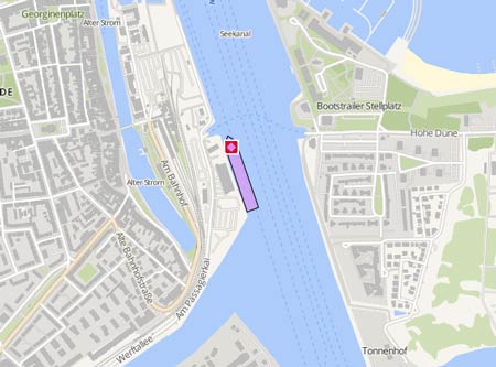
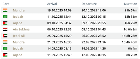
Latest ports
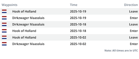
Latest Waypoints
Latest news
Engine failure in Çanakkale Strait
On Aug 6, 2026, at around 8 p.m. UTC, the 'Ocean Mary' suffered an engine failure en route from the port of Yalova to the port of Aliağa during the transit of the Çanakkale Strait off Gelibolu. The situation was addressed immediately under the supervision of the Çanakkale Vessel Traffic Services Center. A pilot accompanied the vessel, while the tugs 'Kurtarma 18' (IMO: 9974890) and 'Kurtarma 19' (IMO: 9995129) took the ship in tow to the Doğanarslan anchorage area, where it was safely moored in pos. 40° 28' N 026° 46' E. Video: https://x.com/kiyiemniyet/status/2085477574356947302/video/1
Upload NewsShip master data
Vessel Name Original :
Imo :
Mmsi :
Callsign Original :
Flag Normalized :
My Vessel Type :
Port Of Registry :
Service Speed :
Status Of Ship Standardized :
Status Date Normalized :
Hull Type :
Hull Material :
Decks Number :
Bulkheads :
Size Class :
Gross Tonnage :
Net Tonnage :
Deadweight :
Teu :
Cargo Holds :
Bale :
Grain :
Fuel :
Fuel Type :
Ballast :
Classed By 1 :
Classed By 1 Status :
Classed By 1 Date Change :
Classed By 2 :
Classed By 2 Status :
Classed By 2 Date Change :
P I Insurer 1 :
P I Insurer Date 1 :
Survey 1 :
Survey 1 Date :
Survey 1 Next Date :
Survey 2 :
Length Overall :
Length Registered :
Length Bp :
Breadth Registered :
Breadth Extreme :
Breadth Moulded :
Depth Moulded :
Draught :
Freeboard Summer :
Freeboard Winter :
Freeboard Tropical :
Engine Power :
Aux Engine 1 :
Aux Engine 1 Bhp :
Aux Engine 1 Kw :
Aux Engine 1 No :
Aux Engine 1 Rpm :
Eng Total Bhp :
Eng Total Kw :
Main Engine Builder :
Main Engine Model :
Main Engine Power :
Main Engine Type :
Propeller :
Propeller Description :
Propelling Type :
Generator :
Generator Description :
Manager Name :
Manager Address :
Manager Location :
Manager Phone :
Manager Fax :
Owner Name :
Owner Address :
Ism Manager Name :
Ism Manager Address :
Ism Manager Location :
Ism Manager Phone :
Ism Manager Fax :
Ism Manager Email :
Ism Manager Website :
Man Owner :
Man Owner Address :
Man Owner E Mail :
Man Owner Internet :
Man Owner Nation :
Man Owner Post No :
Man Owner Telefax :
Man Owner Telephone :
Reefer Pts :
Ex Name 1 :
Ex Name 2 :
Ex Name 3 :
Year Of Built :
Launch Date :
Builder :
Country Place Of Build :
Yard Number :
