

POLARIS


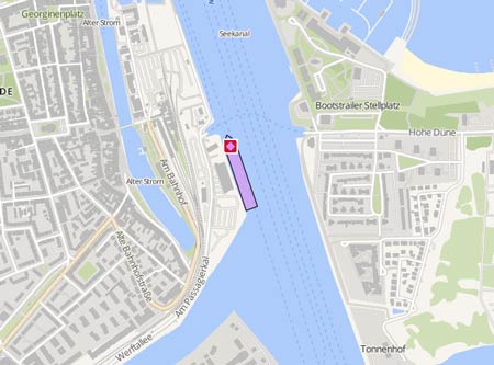
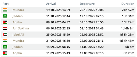
Latest ports
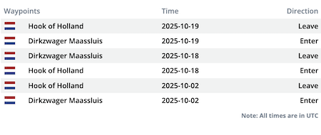
Latest Waypoints
Latest news
Crew member died from electrocution
The investigation of the US Coast Guard into the circumstances surrounding the death of a crew member of the 'Polaris', which occurred about 27 miles from New York Harbour, was continued. The vessel was carrying out installation work on Equinor’s Empire Wind I offshore wind farm on June 2, when he had been electrocuted. The New York command centre of the Coast Guard was notified of a medical evacuation aboard the 'Polaris' involving a crew member unconscious from being electrocuted.
Crew member died in accident
One crew member of the ' Polaris' has died following a maritime incident aboard the tug on June 2, 2025, while conducting operations in the Atlantic Ocean.Tidewater confirmed the fatality in a statement, noting that emergency response procedures were immediately initiated. Despite the efforts of crew members and emergency response agencies, the crew member could not be saved. The tug arrived in New York on June 3 and remained moored at the Global Marine Terminal since. While Equinor did not specified the vessel’s operations, the company is actively constructing the Empire Wind offshore wind project off New York’s coast.
Research Drilling off the Coast of Suriname
The Maritime Authority of Suriname has issued the following Notice to Mariners: "From September 5, 2020 to January 6, 2021, the Noble Sam Croft drillship will conduct exploration drillings off the coast of Suriname at the drilling location 07 ° 23 "401 N - 55 ° 55" 264 W (WGS 84). For safety reasons the shipping should keep a safe distance of 1000 (one thousand) metres from the Noble Sam Croft. The Offshore Support Vessels (OSV) that will assist during the operations are: Southern Tide, States Tide and Polaris. Please note: • Communication is through VHF, all international channels 13, 16, 69, 72. • There is a SAFETY ZONE of 1000 (one thousand) metres from the drilling site. • The Noble Sam Croft is not maneuverable and will display the relevant characters. All ships should take notice of the above mentioned."
Upload News